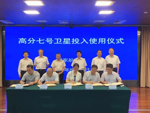
The Gaofen-7 Earth observation satellite was put into service on Aug 20, completing a space-based Earth observation platform with high spatial resolution, temporal resolution and precision.
Developed by China Aerospace Science and Technology Corporation (CASC), Gaofen-7 is China's first sub-meter optical transmission 3D surveying and mapping satellite for civil use.
It will help provide data for basic surveying and mapping, global geographic information assurance, monitoring and assessment of urban and rural construction and agricultural surveys.
Launched on Nov 3, 2019, the satellite is equipped with a double-array stereo camera and a laser altimeter, making it the first instrument of its kind in the world that can provide 1:10,000 3D resolution for surveying and mapping.
In addition to domestic users, the satellite also plays a role in economic and social development and improves China's space competitiveness. Moreover, it will provide space information for countries participating in the Belt and Road Initiative.
During its in-orbit testing, functions like monitoring of geographical conditions, agricultural surveys and road constructions were verified.
The satellite, together with the Ziyuan III satellite, also participated in the height measurement of Mount Qomolangma (Mount Everest) this May and drew a 1:10000 scale topographic map for surveyors.
Further research and application of the satellite in geological information collection and automated data provision will be developed soon.
The Gaofen project was one of the 16 major projects of the national medium and long-term science and technology development plan (2006-2020).
The project was approved in 2010 and several Gaofen satellites have now been launched.
Data collected by the Gaofen series of satellites have been widely used in more than 20 industries in 31 provincial regions in China.
For example, the Gaofen-2 satellite filmed a series of remote-sensing images during the outbreak of the COVID-19 pandemic, which were main references for the construction of the Huoshenshan and Leishenshan makeshift hospitals in Wuhan of Central China's Hubei province, the hardest-hit region in China.
Later in the summer the Gaofen-3 satellite shot photos of the Poyang Lake and provided 24/7 flood data, which greatly improved the region's flood control capacity.
The data also play a role in accurate investigation of ecological natural resources in poverty-stricken areas to help people there eliminate poverty.
Generally speaking, the Gaofen satellites have been used in various fields to promote national economy and offer critical data and technical support to the government.
2020 is a key year for application of data collected by the Gaofen satellites. To firm up construction of the data application system and promote the remote-sensing application industry, a national remote-sensing data sharing service platform is to be built.
Meanwhile, international data exchanges and sharing as well as international products and services will inevitably make China-made Gaofen a core brand.
Joint use of the Gaofen and other satellites will also be increased to contribute more to poverty alleviation, building of a moderately prosperous society in all respects, ecological civilization construction, rural revitalization and the Belt and Road Initiative.

Representatives of enterprises and departments including the Ministry of Natural Resources, the Ministry of Housing and Urban-Rural Development, the National Bureau of Statistics and CASC sign an agreement on operation of the Gaofen-7 satellite. [Photo/sasac.gov.cn]

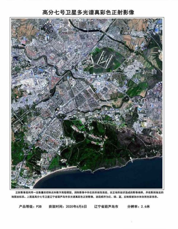
A multispectral true color orthoimage filmed by the Gaofen-7 satellite [Photo/sasac.gov.cn]

A 3D scene diagram drawn by the Gaofen-7 satellite [Photo/sasac.gov.cn]
(Executive editor: Wang Ruoting)